New uNmINeD development snapshot is available for download!
Changes:
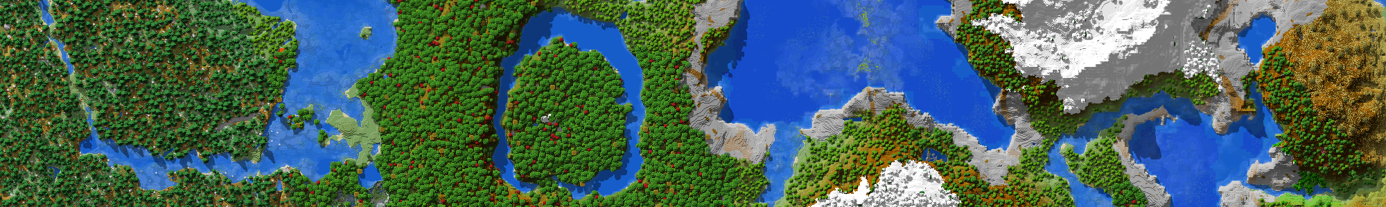
- (GUI) Added altitude settings to make amplified worlds and various world heights look better
- Changed tree log color from green to brown to make buildings with log roofs more visible
- Fixed seagrass and kelp keep appearing when using the slicer
- Fixed grass blocks in 1.12 and older worlds were loaded as
grassinstead ofgrass_block - (CLI) Changed the
(x2,z2)point of the--area=r((x1,z1),(x2,z2))parameter to inclusive - (CLI) Fixed
--imageformatdoes not work with lowercase values - Reworked internals to handle waterlogged blocks and block states better
- Reworked gradient and curve generators to handle custom world heights and MC 1.18 better
There are various mountain heights across Minecraft versions and custom/modded world types. Using the altitude settings the elevation gradient and other map style elements can be adjusted to match the actual height of the mountains and the actual sea level. uNmINeD determines the default settings based on world version.
Is there away to show player location on the maps ?
I’ve always got a access violation error during rendering. In most cases after change from z0 to z1. I send you a mail. I hope this can be fixed.
Fixed, thank you!
Elevation gradient is fixed for the 1.12 worlds, but it still does not show all the block types. Red sand, stained clay, flowers, beds, wool, etc., etc. etc., doesn’t show up in 1.12 worlds, only in 1.13 and above worlds.
This incarnation of uNmINeD is completely rewritten from scratch to handle 1.13 block palettes, and uses a converter for pre-1.13 worlds. The converter is not yet complete, it does not handle block data values required for wool colors and other block variations. It’s on the todo list.
Is it possible to create a tabbed map showing Overworld, Nether and End together? Could the exported images have a black background instead of white for sections of a tile that do not contain map data?
I agree for this one, have an option for dark or bright background, even within the GUI app itself, sometimes if I enable night mode or cave mode, but the bright background means I can’t see details clearly